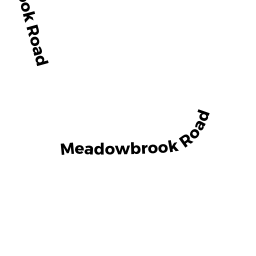
10 BELDON RD
Owner Information
FINN THEODORE J + LESLIE D
10 BELDON RD
DOVER, MA 02030


Property Details
10 BELDON RD is classified as a Single Family Residential (Colonial).
The primary structure on this property was built in 2000. There are 5,139ft2 of built area within this property. There is 5,139ft2 of residential/living space within this property. This property is listed as having 12 rooms.
10 BELDON RD is valued at $1,492,000. The land is valued at $632,700 and the structures are valued at $859,300.
This property is in Zone R1. Confirm with local Zoning Board authorities to ensure there are no overlays or other easements on this property.
The most recent deed for 10 BELDON RD is recorded at the local registrar in Book 14605, Page 035. 10 BELDON RD was last sold on Tuesday, December 19, 2000 for $1,100,000.
Assessment data from fiscal year 2022.
Flood Data
According to the FEMA National Flood Hazard Layer, this property does not appear to be in a flood zone. It may also be in an area not yet reviewed. Nonetheless, confirm this information prior to taking any action.
To view the flood hazards around this property, create a FEMA "Firmette" Map of the area around 10 BELDON RD.
Broadband Internet Providers
| Provider | Type | Bandwidth (mbps) | |
|---|---|---|---|
| VSAT Systems, LLC. | Satellite | 2 | 1 |
| Verizon New England Inc. | Fiber | 940 | 880 |
| HughesNet | Satellite | 25 | 3 |
| Comcast | Cable | 1000 | 35 |
| Crown Castle Fiber | Fiber | 0 | 0 |
| GCI Communication Corp. | Satellite | 0 | 0 |
| Viasat Inc | Satellite | 100 | 3 |
Broadband service provider data from December 2020.
Adjacent Properties
- 32 MEADOWBROOK RD
Single Family Residential owned by RED BARN ASSOCIATES LLC - 8 BELDON RD
Single Family Residential owned by JOHNSTONE C BRUCE TRUSTEE - 12 BELDON RD
Single Family Residential owned by TUERK CRISTA R - 30 MEADOWBROOK RD
Single Family Residential owned by HALL BRYAN A + KIMBERLY - 0 WILSON`S WAY
Undevelopable Residential Land owned by BISSON STEPHEN W